
China Releases 3D Images of Landslide-Affected Area in Tibet, Intensifies Rescue Operations with Advanced Technology

29th August 2026, Kathmandu
China has released 3D images of the landslide-affected area near the Gyirong border port in Tibet. Advanced technology and drones are being utilized to accelerate rescue operations.
China Releases 3D Images
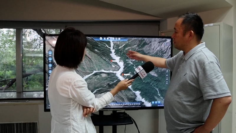
An advanced 3D image of the landslide-affected area in southwest China’s Tibet Autonomous Region has been successfully generated. China has released three-dimensional images of the disaster zones in Xizang (Tibet) to streamline and enhance ongoing rescue operations.
Chinese authorities have dramatically accelerated search and rescue efforts at the Gyirong border port, with rescue personnel racing against time to save lives.

Casualties and Missing Persons
According to the Regional Emergency Management Department, as of 3:00 PM on Friday, five people have lost their lives while 558 remain missing. The disaster struck after a landslide originating from Nepalese territory reached the Gyirong Port area. Authorities have confirmed that 260 of the missing individuals are foreign nationals.
Deployment of Advanced Technology and Rescue Teams
The National Fire and Rescue Administration reported a massive mobilization of personnel and equipment in the remote mountainous border region:
-
A total of 681 fire and rescue personnel and 113 vehicles arrived at the site by Friday morning.
-
6,612 pieces of rescue equipment and emergency supplies were dispatched to Gyirong village.
-
Initial deployments included 141 rescue workers and a high-altitude helicopter, followed by an additional 111 members of the China Search and Rescue Team.
Advertisement

Three Specialized Rescue Teams
To optimize the operation, fire and rescue personnel have divided themselves into three specialized units:
First Team: Operating rubber boats along waterways.
Second Team: Conducting foot patrols across rugged mountainous terrain.
Third Team: Executing aerial surveillance and delivering relief supplies via drones.
Additionally, a specialized unit deployed to the primary disaster zone is using drones and binoculars to map, inspect, and conduct targeted surveillance of the site and the newly formed barrier lake.
Risk Management and Scientific Survey
Thirteen experts from the Shanghai Fire Research Institute (under the Ministry of Emergency Management) have arrived at the scene. Furthermore, the state-owned engineering and rescue enterprise China Aneng deployed a 15-member team on Friday.
The team is utilizing drones, portable satellite stations, and mobile surveillance cameras to conduct precise on-site surveys of roadblocks and surrounding infrastructure, aiming to gather accurate data for managing risks associated with the newly formed barrier lake.
According to rescuers, the massive debris blockage accumulated approximately 3 kilometers upstream from the port must be safely neutralized and resolved before it can be fully cleared. (CCTV Plus)
For more: China Releases 3D Images